Haanja campfire site
Võru County, Haanja Nature Park
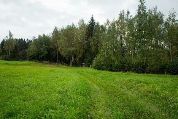
The campfire site is near the Suur Munamägi hill, about 300 m from the Suur Muna cafe. Parking by the side of the access road. A nice place for making campfire and having a picnic. In the peace and quiet here you can stay in a tent and enjoy the natural environment in the rolling Haanja area. There are no swimming places nearby, but you are near the highest peak of the Baltic countries!
| Phone | +372 501 9564 |
|
info.pahni@rmk.ee
| |
| Type of object | Campfire site |
| Parking facilities | Parking (for 6 cars) by the side of the access road. |
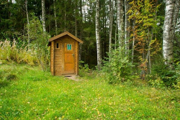
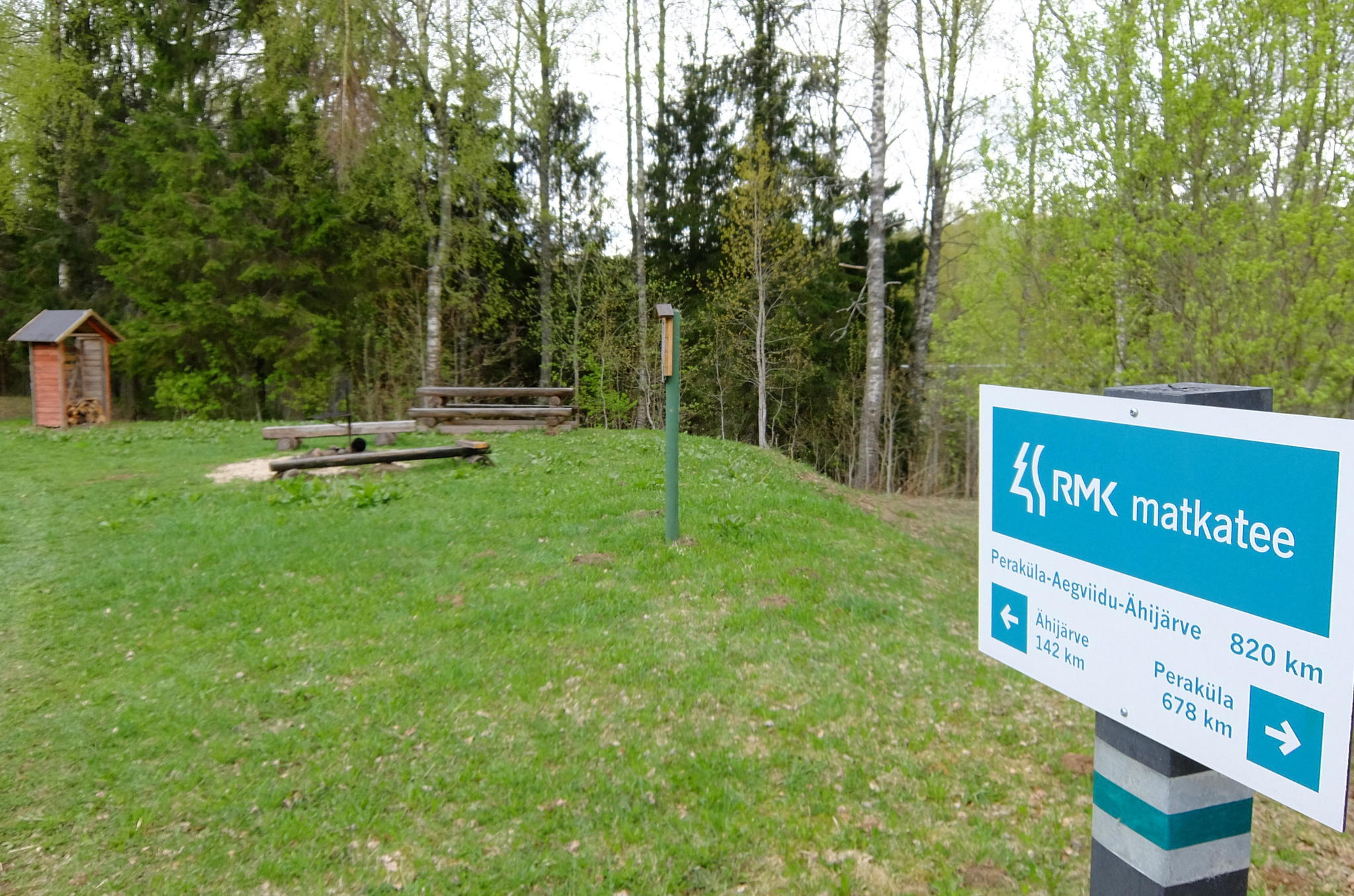
| Amenities | Campfire site with benches, picnic tables, fire ring with barbecue grill, firewood shelter, dry toilet. |
| Camping facilities |
The maximum number of tents (for 4) allowed is 4. |
| Campfire site | Fire ring with a grill. |
| Hiking options |
The campfire site is on the RMK Peraküla-Aegviidu-Ähijärve Hiking Route. |
| Sights | Suur Munamägi, rolling terrain. |
| Additional information |
|
| Restrictions | The campfire site is located in Haanja Nature Park, about restrictions please read here. Further information about restrictions can be obtained from the Environmental Board (+372 662 5999, info@keskkonnaamet.ee). |
| Location | Haanja village, Rõuge municipality, Võru County. Object no 2 on the nature park map. |
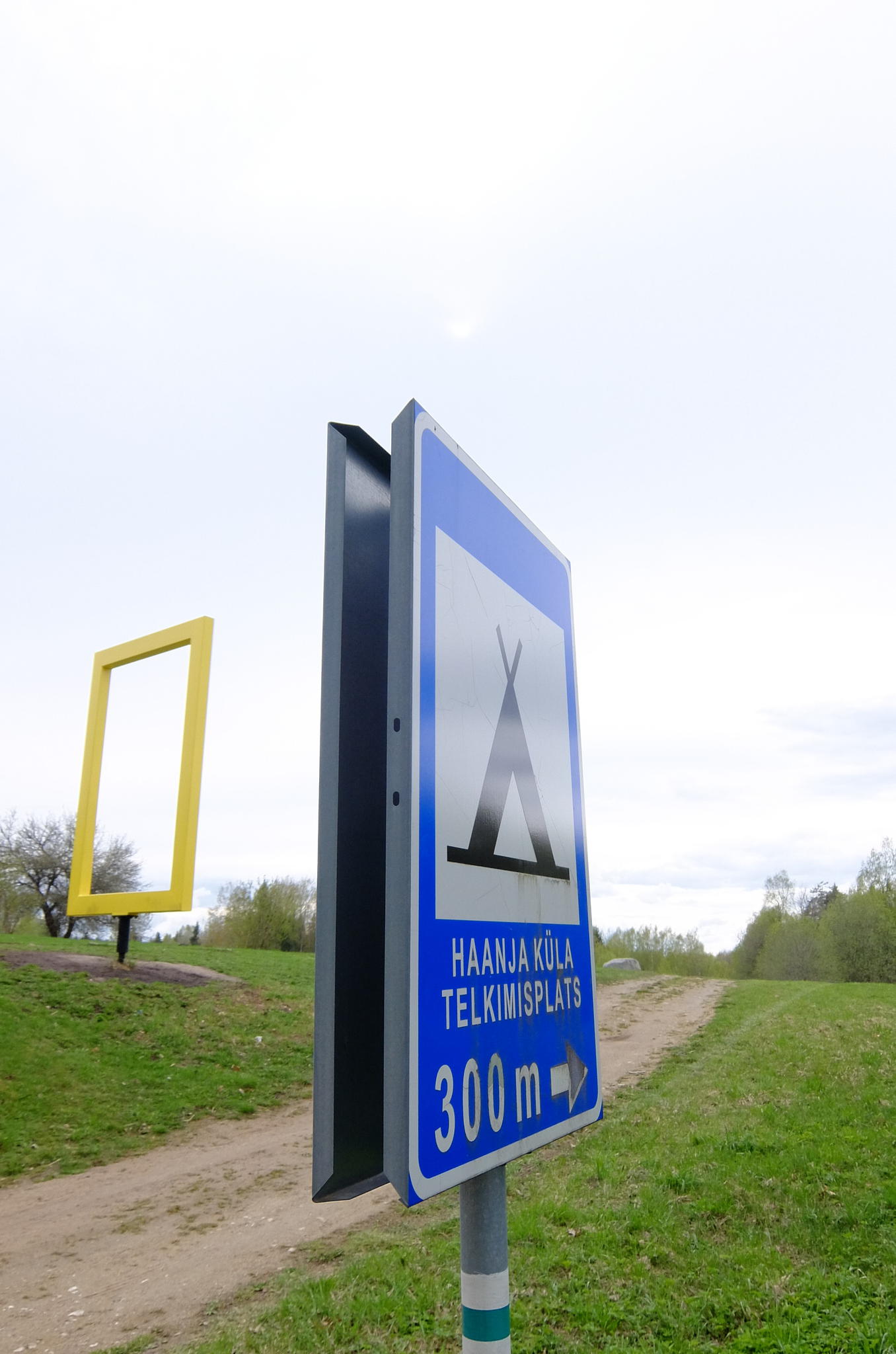
| Driving directions | Drive from Võru towards Luhamaa (Road no. 2, E263) and immediately after the railway crossing turn left. Go past Alexela filling station and after 500 m turn right (follow the signs “Haanja 12 km”, “Suur-Munamägi 12 km”). Drive past the Kose bus stop (Favora filling station is to the left) and go straight on to the sign of Haanja. Drive about 1.5 km, there is the Suur Munamägi parking area with information boards to the left and the signs “Rogosi mõis Ruusmäel 10 km”, “Plaani kirik 6 km” on the right. After that there is a sign “Haanja küla telkimisplats 300 m”, turn right following the sign to the campfire site. |
| Geographic coordinates | Long-Lat WGS 84 latitude: 57.71304 longitude: 27.05078 |
| L-EST 97 x: 6400908.5 y: 681789.9 |