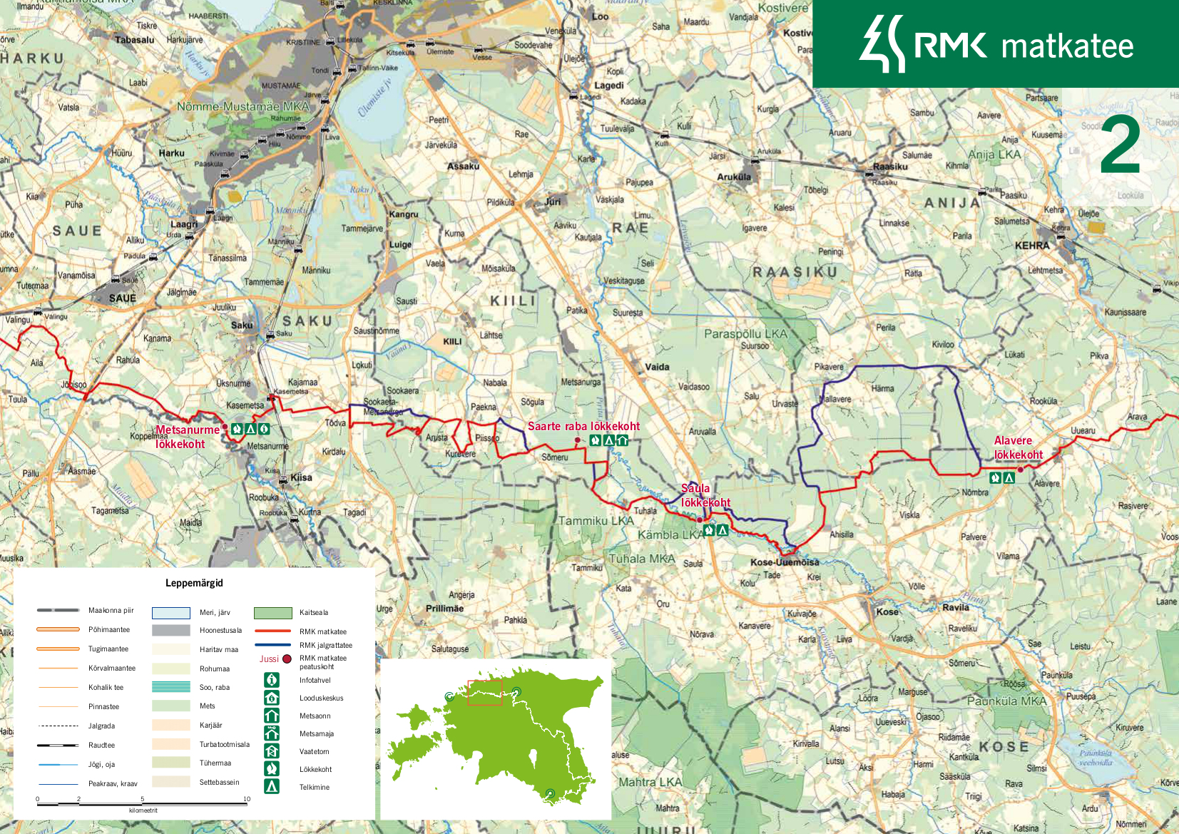
RMK hiking route Peraküla-Aegviidu-Ähijärve / Ohtu-Alavere (87 km)
Harju County, Surroundings of Tallinn Recreation Area
The Keila-Valing section is difficult to cycle, the road is muddy and the rails are driven in.
Due to the improvement of the forest export route on Kose - Alavere - Uuemõisa section, the hiking trail at Pikavere-Viskla Road is muddy and difficult to pass.
Due to the improvement of the forest export route on Kose - Alavere - Uuemõisa section, the hiking trail at Pikavere-Viskla Road is muddy and difficult to pass.
This section of the hiking route is quite varied. Although most of the route goes along larger and smaller gravel roads, the trail introduces also some long, narrow and relatively wild paths, which can be challenging to pass. There is also a patch of bog on this route – namely, the Saarte bog in Kiili municipality. In addition, the hiking route runs through the Tuhala-Nabala Nature Reserve, formed for the protection of the karst area. Due to its closeness to Tallinn, in this section one must also cross several larger main roads.
| Phone | +372 676 7842 |
| info.viimsi@rmk.ee | |
| Type of object | Hiking trail |
| Parking facilities |
Parking for 2-3 cars is available at each campfire site
|
| Amenities |
The trail is marked with signposts and white-green-white paint markings. The rest stops on the trail and distances between them: |
| Camping facilities | yes |
| Outdoor fireplace | yes |
| Campfire site | yes |
| Water |
Non-potable water can be taken from the rivers of Keila, Tuhala and Pirita and the Angerja stream. |
| Hiking options | yes |
| Additional information |
Before going on a nature walk please read the Environmental code of conduct (freedom to roam), rules of conduct and waste-sorting policy
|
Click on the map to open and download pdf