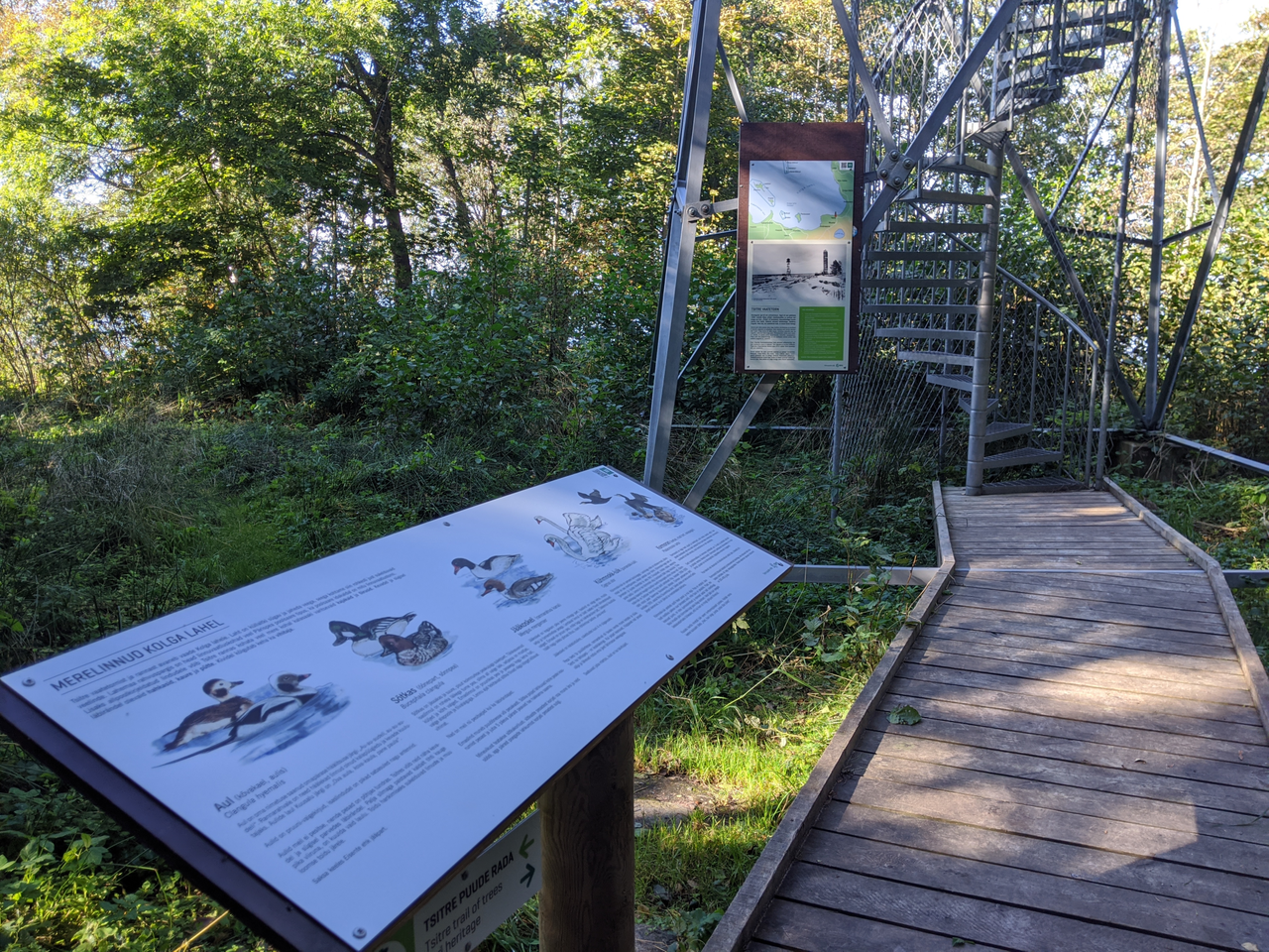
Tsitre trai's observation tower (ca 300 m from the parking)
Harju County, Lahemaa National Park
The observation tower is located
on Tsitre trail of trees. Directly from Tsitre campsite' s parking lot it is ca 300 m to the tower. Walking from the beginning of the trail to the tower is about 650 m. The tower has been built in place of the former Soviet border guards' observation tower. In addition to the wonderful sea view, part of the western coast of Juminda Peninsula can be seen from the tower.
on Tsitre trail of trees. Directly from Tsitre campsite' s parking lot it is ca 300 m to the tower. Walking from the beginning of the trail to the tower is about 650 m. The tower has been built in place of the former Soviet border guards' observation tower. In addition to the wonderful sea view, part of the western coast of Juminda Peninsula can be seen from the tower.
| Phone |
+372 676 7010 +372 329 5555 |
|
info.oandu@rmk.ee
info.lahemaa@rmk.ee | |
| Type of object | Observation Tower |
| Parking facilities |
Parking for 20 cars or 1 bus in Tsitre campsite's parking pockets |
| Amenities | Metal observation tower, boardwalk |
| Camping facilities | Tsitre campsite |
| Outdoor fireplace | yes |
| Campfire site | yes |
| Hiking options |
Tsitre trail of trees
|
| Sights | Old forest park with interesting trees, the ruins of a summer manor.There are several other beautiful sites and historical places nearby: Muuksi hill, Hundikangrud, Kolga Manor and Museum 8 km from Tsitre. |
| Additional information |
Before going on a nature walk please read the Environmental code of conduct (freedom to roam), rules of conduct and waste-sorting policy
|
| Restrictions |
Up to 5 people can stay in the observation tower at the same time. It is forbidden to go to the tower during thunderstorms. The trail is situated in Lahemaa National Park, view the restrictions on visiting here. Additional information from the Environmental Board: +372 662 5999, info@keskkonnaamet.ee. |
| Location |
Kuusalu Municipality, Harju County |
| Driving directions |
The observation tower location marker on the map shows the location of the trail's and campsite's parking lot.
Tallinn-Narva road (E20) 39. km, Kuusalu, turn right in the direction of Leesi. 800 m after the Kuusalu crossroad turn to the left (sign "Leesi 17 km"), continue under the viaduct and cross the ring road until you reach Jõelähtme-Leesi road, from there turn right (sign "Leesi 23 km") turn left at the village sign (sign "Leesi 22 km") and drive 8 km to the post, where the camping area and the trail sign point to the left.The road splits in two, you can park directly on the road leading to the sea, 150-200 m by the roadside. The beginning of the trail is on the right side of the road opposite the well. |
| Geographic coordinates | Long-Lat WGS 84 latitude: 59.519671 longitude: 25.514003 |
| L-EST 97 x: 6598973 y: 585699 |