Varbola stronghold
Rapla County, The Surroundings of Tallinn Recreation Area
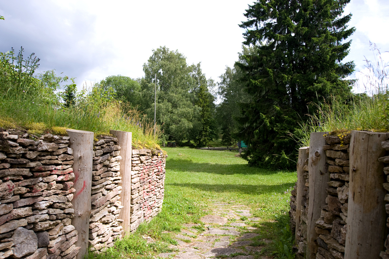
Varbola Jaanilinn was one of the largest fortresses in Estonia. The yard, approximately 2 hectares in size, is surrounded on all sides by a limestone wall, supported by dry masonry and logs. The sloping sides of the wall were formed of the crumbled upper parts. The total length of the wall is 580 m. The height of the wall on the outside is 7 - 10 m, inside 2 - 7 m.
The stronghold was used in the 12th to 14th centuries; in the 15th to 17th centuries the courtyard was used as a cemetery. Numerous coins from that period there have been found, most of them were sacrificial offerings.
The stronghold was used in the 12th to 14th centuries; in the 15th to 17th centuries the courtyard was used as a cemetery. Numerous coins from that period there have been found, most of them were sacrificial offerings.
| Phone | +37 2676 7842 |
| info.viimsi@rmk.ee | |
| Type of object | Other |
| Parking facilities | 2 parking areas for 120
cars in total |
| Amenities | 2 campfire sites, 2 recreation sites with shelter, open-air stage with shelter, 80 benches, 3 information boards At the parking area there are 2 two-stall toilets, 2 information boards with general information and the layout map of the stronghold. |
| Camping facilities | yes |
| Outdoor fireplace | yes |
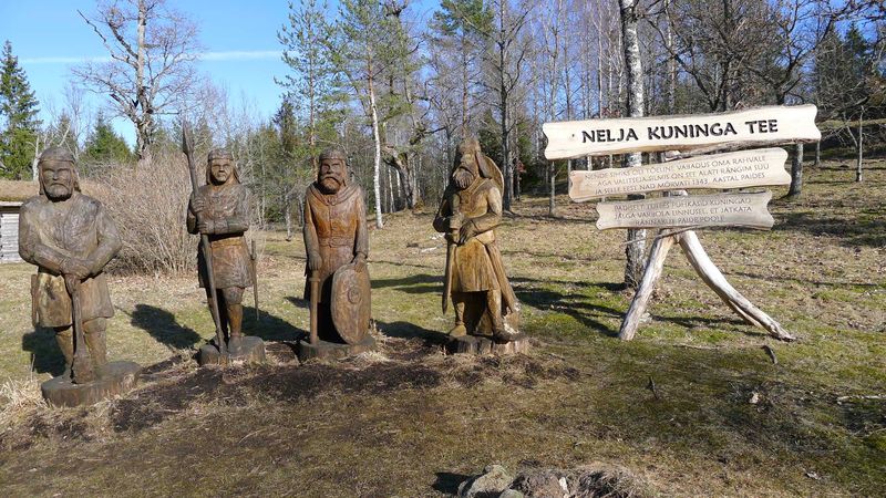
| Sights | Wall of the stronghold,
stone-throwing catapult, siege tower, old well, oak stand |
| Berries and mushrooms | Milk-caps |
| Additional information |
Before going on a nature walk please read the Environmental code of conduct (freedom to roam), rules of conduct and waste-sorting policy
|
| Location | Varbola village,
Märjamaa municipality, Rapla County Object no 8 on recreation area map |
| Driving directions | Drive 50 km
along the Tallinn-Pärnu road (Road no. 4), turn left towards Varbola. Drive
through the Varbola village 4 km up to
roadside signs. The stronghold is to the right of the road. |
| Geographic coordinates | Long-Lat WGS 84 latitude: 59.039811 longitude: 24.505736 |
| L-EST 97 x: 6544659.7 y: 529032.1 |